
Shoreline ZIP Code Coverage
Three current candidates recur for Shoreline in official Washington administrative sources: 98133, 98155, and 98177. Yet those sources do not establish a live postal boundary. USPS assigns codes for mail delivery, while the City of Shoreline maps its own municipal line. The working Shoreline ZIP code directory therefore keeps each code's source and caution visible instead of presenting one broad, fixed boundary.
| ZIP | Areas Associated | Postal Label Context | Use and Caution |
|---|---|---|---|
| 98133 | North Shoreline and Northgate-labelled administrative area | Seattle or Shoreline may appear by address | Validate the full street address; not every address is within Shoreline |
| 98155 | Shoreline and Lake Forest Park | Strong Shoreline association | The code crosses local place context, so check the city map |
| 98177 | Richmond Beach and Shoreline area | Seattle or Shoreline labels can vary | A neighborhood name does not set the municipal jurisdiction |
| 98160 | Richmond Beach in an older health-planning list | Legacy or administrative appearance | Do not treat as a current deliverable Shoreline code without USPS confirmation |
The labels above come from dated Department of Health documents and are a research aid, not a substitute for a current USPS return. The older list associates 98133 with Northgate, 98155 with Shoreline and Lake Forest Park, and 98177 with Richmond Beach. A later planning document also used 98160. That mismatch is the reason every address needs a fresh postal check.
Verify Shoreline ZIP Codes
The USPS ZIP Code Lookup is the source for present mail routing. It offers paths by street address, by city and state, and by ZIP. Use the street-address form when checking one property because a citywide response cannot resolve a block that sits near a postal or municipal edge. Record the standardized street, returned city, state, ZIP, and ZIP+4.
The official form shows the routes used for this check. Open the USPS source above before reviewing the saved capture.
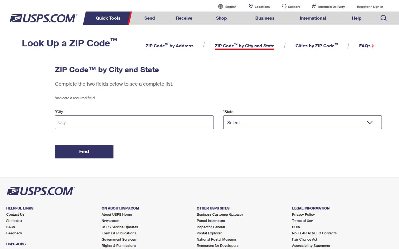
The capture documents the form, not a current Shoreline result. Live results were not exposed during text inspection, so no code should be called current solely because it appears in this image or in an older administrative list.
| USPS Route | Fields | Best Use |
|---|---|---|
| By Address | Street, city, state | Confirm one deliverable address and its normalized code |
| By City and State | City, state | Review codes associated with a postal city name |
| By ZIP Code | Five-digit ZIP | Check the city labels returned for a known code |
Label Shoreline ZIP Evidence
A useful ZIP entry says where it came from. Mark a value as “USPS returned” when it came from a current address search. Use “municipal GIS or parcel address” when it appears in a city or county system. Older agency files should be marked “administrative document” or “legacy planning list.” Those labels stop an old code from being mistaken for a current delivery route.
Store the access date with dynamic results. Postal routing can change, and city map files receive dated updates. A Shoreline ZIP code directory should preserve the raw address as well as the standardized form, including directional, suffix, unit, returned postal city, and ZIP+4. The parcel and municipal jurisdiction belong in separate fields.
Note: A ZIP found in a dated planning document remains historical evidence until USPS confirms it for the exact address.
Map Shoreline ZIP Addresses
The city's February 13, 2026 city map supplies the municipal side of the comparison. Its legend includes the city limit, roads, tax parcels, parks, schools, civic sites, rail, and light-rail stations. The February 12, 2026 neighborhood map supplies named local geography.
Neither map assigns mail delivery. Use the municipal line to answer whether a parcel sits in Shoreline, then keep the USPS-returned postal city as its own value. This matters along edges near Seattle, Lake Forest Park, Edmonds, and Woodway. A postal label may point to one city while the parcel receives permits, records, and services from another.
Neighborhood names add context, not proof. Richmond Beach, Echo Lake, North City, Ridgecrest, and other Shoreline names can help locate an address, but they do not replace parcel or ZIP evidence.
Find Shoreline Residents by ZIP
No official local portal with a current ZIP-wide resident filter was located. That gap changes the proper workflow. First confirm a specific address through USPS. Next use the county parcel map to establish its municipal jurisdiction. Only then consult a record tied to the person's lawful purpose. Do not turn an agency source into a compiled list of people.
- Enter the complete address in USPS and save the standardized postal result with the access date.
- Open King County Parcel Viewer and search the same address. Record the parcel number and jurisdiction.
- Use the Assessor property report for parcel facts, while keeping taxpayer, owner, situs, and mailing labels distinct.
- If reconnecting family through old property, search Washington unclaimed property by name, city, and ZIP, then verify the claim through the state.
- Once the postal area is narrowed to an address, use the Shoreline street directory for the street and parcel workflow.
The Assessor and Parcel Viewer start with parcel or address data, not a documented ZIP filter. King County My Voter Information is a self-service identity lookup, not a public ZIP browser. Avoid claims that either system can return everyone in one Shoreline code.
Shoreline ZIP Reconnect Search
Washington's unclaimed property search is one official statewide source that exposes both City and ZIP fields. It also accepts last or business name, first name, and property ID. This can support a lawful effort to reconnect a relative or trace an estate asset when a past Shoreline place is known.
A match does not show that someone now lives in that ZIP. Unclaimed property reflects the address associated with the holder's old report, and the city or code may be stale. Record the property ID, follow the state's claim process, and supply proof only through the official state route.
Can a ZIP search list Shoreline occupants? No official city or county source found in the research offers that function. A ZIP is a mail-routing area, not an occupancy roll.
Shoreline ZIP District Context
A parcel can belong to several districts that do not follow ZIP lines. King County's parcel and Districts Report can show municipal jurisdiction, voting district, county council district, congressional and legislative districts, school district, District Court electoral district, fire authority, library district, and other planning notes. Those layers explain which custodian might hold a record.
For example, the research sample at 17544 Midvale Ave N is identified as Shoreline jurisdiction and also carries separate election, school, court, and fire designations. That sample shows why a single ZIP cannot answer all geographic questions. It is a field example, not a statement about a resident.
Use district data to route civic research. Keep coordinates, district names, parcel facts, and postal code in distinct columns. A district overlap never proves identity or residence.
Shoreline ZIP History Limits
Shoreline incorporated in 1995 after decades as unincorporated King County. That legal change affects the keeper of permits and road records, but it did not make postal codes and city lines the same. A record before incorporation may use a Seattle postal label, a plat name, a rail stop, or a local place name rather than the current city form.
Historical sources mention North Trunk Road, the Interurban, Richmond Beach, and Echo Lake. Preserve those old terms next to the normalized current address. Do not claim a ZIP split, street renumbering, or postal-city change unless USPS or a dated city or county source documents it. No verified mass renumbering table was found.
City permit records from 1995 through 2000 use a public-records request, while eTRAKiT covers 2001 forward. Pre-August 1995 permit work belongs with King County. ZIP history alone cannot select the right custodian; the event date and jurisdiction do that.
Shoreline ZIP and City Limits
ZIP boundaries serve delivery routes. Municipal limits determine city government. County, school, fire, library, voting, and court districts form still more layers. A Shoreline street address can return Seattle as its postal city, and one code may touch Shoreline, Seattle, or Lake Forest Park. Write down both the postal city and municipal city rather than forcing them to agree.
- ZIP
- A five-digit USPS routing code associated with delivery areas, not a city boundary.
- ZIP+4
- The five-digit code plus four digits that narrow delivery to a smaller segment.
- PO-box ZIP
- A code used for post-office boxes rather than ordinary street delivery.
- Unique ZIP
- A code assigned to one large organization or destination.
- Carrier route
- A group of addresses served along one postal delivery path.
Boundary check. Confirm mail routing with USPS and legal jurisdiction with the city or county parcel map. One cannot replace the other.
Use postal geography to narrow the area, then verify a document at its source. Never infer that a person occupies an address merely because a name and ZIP occur in the same old record.