
Walk a Shoreline Street
A sound street-by-street search moves from geography to documents. Start with the exact house number and directional, then let the parcel identifier connect systems that do not index an address in the same way. Shoreline uses many numbered streets, and north or northeast can change the result. A current label may also differ from the name in an old plat.
- Locate the address in the King County Parcel Viewer. Record its parcel number, jurisdiction, and report links.
- Open eReal Property for the legal description, land and building facts, and taxpayer or owner field.
- Search Shoreline eTRAKiT by address or parcel. Preserve each person's displayed role.
- Carry the parcel and legal description into Landmark, then arrange instruments by recording date.
- For an older household, test the street and former names in reverse directories, plats, and archival maps.
This sequence supports family history, house research, and verification of a sale document. It also exposes conflicts. When the map, assessment report, and deed disagree, use the recorded instrument for the legal transfer and ask the custodian about later updates.
Shoreline Street Directory Map
Parcel Viewer is the geographic bridge for the Shoreline street directory. Search modes accept an address, parcel number, or condominium name. Find Intersection adds on-street and cross-street fields. After choosing a parcel, the summary can show jurisdiction, taxpayer name, property address, present use, appraised value, lot area, levy code, buildings, and report links.
| Search control | Input | Best use | Limit |
|---|---|---|---|
| Address | House number and street | Find one Shoreline parcel | Directional and suffix must match |
| Parcel number | County identifier | Reconnect a known record | Not a person search |
| Condo name | Development name | Find a shared site | Unit detail may require records |
| Intersection | Two street names | Orient an old road | No ownership conclusion |
| Select and buffer | Parcel and distance | Study nearby geography | Lines are approximate |
The viewer also offers parcel labels, zoning, measuring, selection, buffer, and export tools. Selection is a research aid, not a resident list. A touching lot does not prove that its owner lives next door.
Open the county parcel map before reviewing the captured interface.
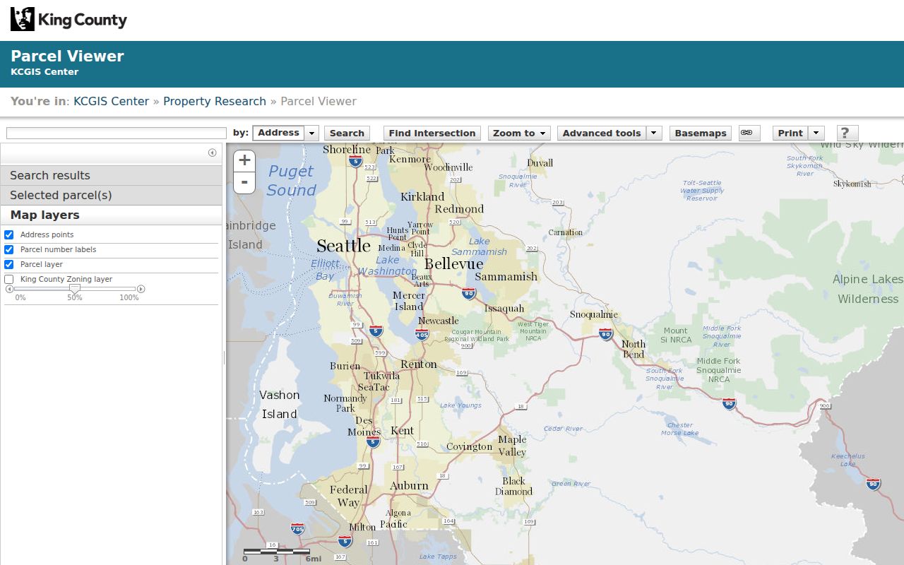
The capture shows why mapping belongs early: it connects the street to a stable parcel without claiming current occupancy.
Shoreline Records by Address
No office maintains a complete roll of everyone on a Shoreline street. Address-keyed records document ownership, land, improvements, and past listings for distinct purposes. The date and named role matter as much as the name.
| Address source | Custodian | Evidence returned | Access route |
|---|---|---|---|
| Assessment | King County Assessor | Taxpayer, parcel, legal description, land and building facts | Free online reports |
| Parcel geography | King County GIS | Approximate lots, zoning, districts, nearby parcels | Free viewer |
| Recorded instruments | King County Recorder | Parties, type, date, number, parcel or legal description | Index; web, mail, or counter copies |
| Permits | City of Shoreline | Site, contacts, inspections, conditions, chronology | eTRAKiT or request |
| Historical directory | Libraries and archives | Dated listing by street or name | Scans or reading room |
The by-address chain is strongest when the same parcel and legal description recur. A taxpayer address can sit outside Shoreline. A permit contact may be an applicant, designer, or contractor. Record the displayed role without converting it into a claim of residence.
Read Shoreline Property Reports
The Assessor's eReal report expands the map result with jurisdiction, legal description, present use, zoning, lot size, utility information, building count, area, and age. Reports can lag changes, so pair them with the deed and note the date searched.
Visit eReal Property to see its public entry screen.
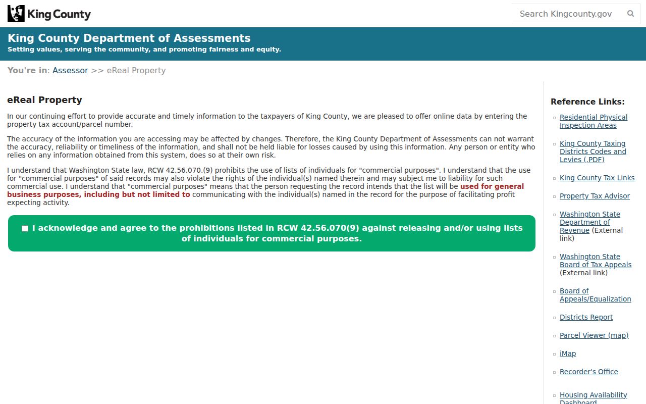
The captured screen reinforces a core street directory rule: describe the property account, not every person at the site.
- Parcel
- A county identifier for a mapped tax lot, often more stable than a street label.
- Situs address
- The physical property address, distinct from a taxpayer mailing address.
- Plat
- A recorded map dividing land into tracts, blocks, lots, streets, or easements.
- Criss-cross directory
- A directory arranged by street and house number rather than surname.
These terms keep sources aligned. They prevent an old plat, a tax mailing destination, and a current address from becoming one false field.
Shoreline Permits Along Streets
Shoreline's permit trail changes by era. Public eTRAKiT coverage begins in 2001. For August 1995 through 2000, send a focused request to the City Clerk. Earlier permits belong with King County Department of Local Services because the city had not incorporated.
The project form supports project number, type, name, address, owner, applicant, parcel, and applied or closed date. Operators include begins with, contains, equals, at least, and at most. Results can include site information, contacts, fees, inspections, conditions, reviews, and chronology.
Compare an address against the eTRAKiT permit form.
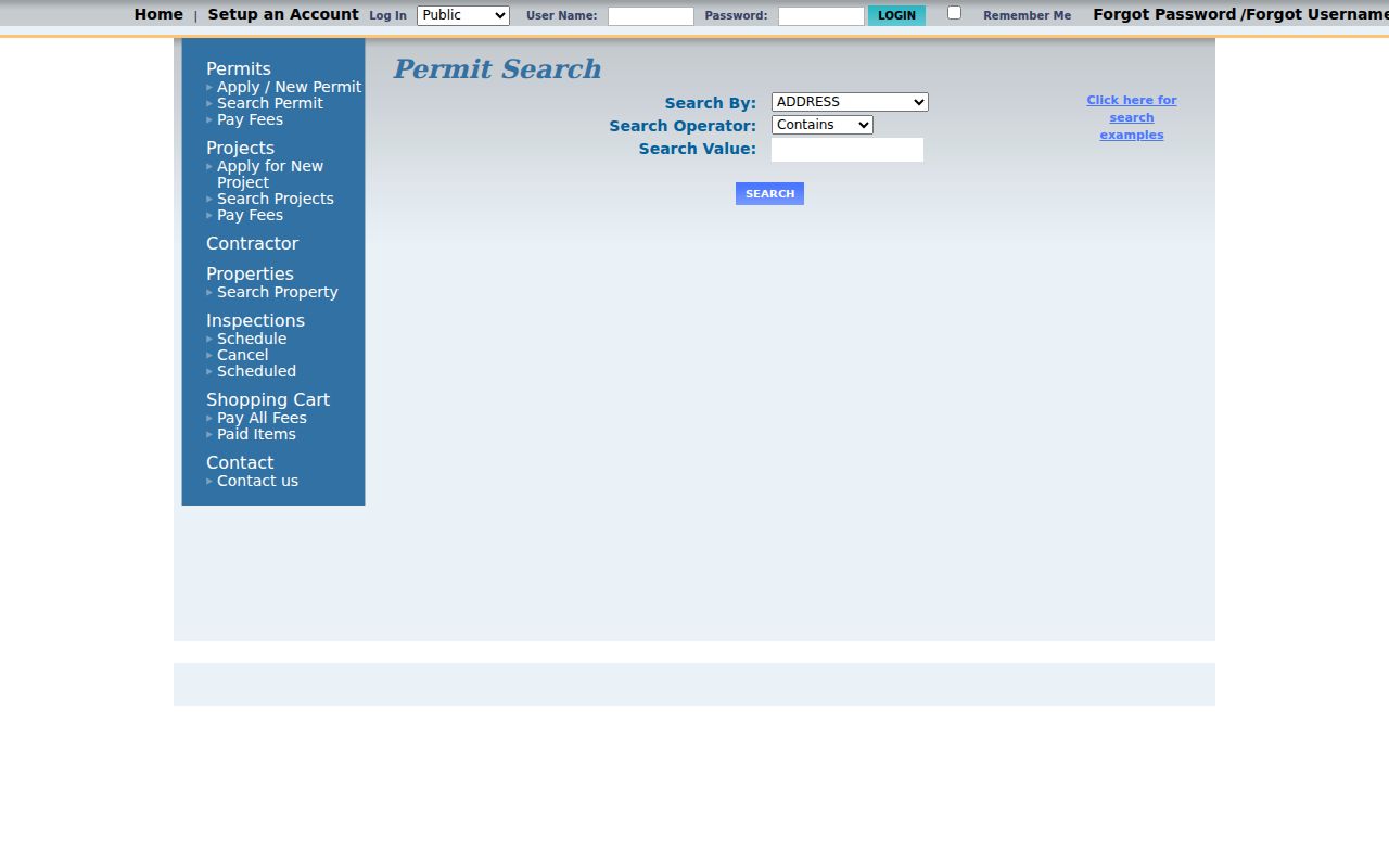
The controls make date, parcel, and permit-number notes useful when a whole-street query returns too much.
Note: A permit contact identifies a project role, not proof that the person occupied the Shoreline address.
Deeds Behind Shoreline Streets
Landmark turns a parcel into a recorded chain. Search by parcel ID, grantor or grantee, instrument number, date, document type, book and page, consideration, legal description, or Torrens. A grantor gives an interest; a grantee receives one. Follow deeds, deeds of trust, reconveyances, easements, covenants, liens, releases, and later deeds in order.
The index extends from 1976 to the present, while most images begin August 1, 1991. Parcel indexing becomes more useful around 1997 and was not consistent until about 2002. Search party names and legal descriptions across gaps. The General Recordings Index for 1853 through 1975 is on microfilm at King County Archives.
Open Landmark to inspect its name, document, and parcel tabs.
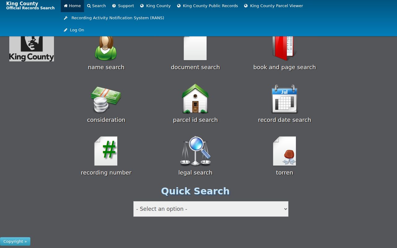
The capture shows several paths to an instrument. Online images are uncertified; copies are also available online, by mail, or at the Recorder counter.
Older Names on Shoreline Streets
Historical geography is central to address research. Richmond Beach was platted in 1890, the Great Northern Railroad arrived in 1891, and the Interurban trolley followed in 1906. North Trunk Road received brick work around 1912 and 1913. Aurora commercial growth came by the late 1930s, followed by broad postwar development. An older source may use a rail stop, tract, or North Trunk Road instead of a current number.
Shoreline incorporated in 1995. Label an older search “unincorporated King County” and a newer one “City of Shoreline.” That split directs requests to the right custodian and explains why no municipal file exists for an early event.
The city Historic Property App and aerial imagery provide leads. Two component inventories date to 1978, when the area was unincorporated. Confirm each map point with the assessment, permit, plat, or recording.
Shoreline Streets Before Incorporation
For family or house history, bridge the current parcel to archives. Washington State Archives holds limited assessment rolls from 1866 through 1937 and property cards from 1937 through 1972. A card may contain a photo, construction notes, exterior sketch, assessment, segregation dates, parcel number, and partial ownership. It rarely provides every owner, price, floor plan, builder, or zoning change.
Prepare the parcel, legal description, tax year, current and former street names, and likely township, section, and range before contacting the Puget Sound Regional Branch. Many card requests need more than an address.
The Shoreline city directory collections can supply a dated name lead. A missing year may reflect a gap in the surviving run rather than a move.
Shoreline Voter Data Boundaries
King County My Voter Information is for a person checking a supplied identity and address. It requires any three of first name, last name, birth date, and house number. It is not a tool for browsing all people along a street.
Washington restricts voter-list use under RCW 29A.08.720 and RCW 29A.08.740. Address Confidentiality Program records may substitute or suppress an address. A miss cannot prove that someone never lived in Shoreline, and current data should not be copied into a lasting roll.
Lawful use. Use Shoreline address records for careful personal, civic, or family research. Never use them to stalk, harass, intimidate, or expose a protected person.
Limits of Shoreline Street Records
A Shoreline street directory cannot establish a complete household. Ownership, tax mailing, a permit role, and a historical listing describe different ties to an address. Many residents never appear in property records. Others may be protected, absent from one volume, or indexed under a former road name.
GIS lines are approximate. Recorded instruments can be superseded. Assessment changes may still be processing. Directory books record one publication snapshot. Keep a source date, exact field label, named role, and uncertainty note with every result.
When online access fails, use the documented fallback. Ask the Recorder for a copy by mail, phone, or counter; request 1995–2000 permits from Shoreline; ask King County for older permits; and contact archives for earlier recordings and cards. That full chain is more reliable than forcing every address into one portal.
Recorder service includes an online cart for certified and uncertified copies. Uncertified copies may print at once, while certified copies are mailed within five business days. The current counter is at 201 South Jackson Street, Suite 204, in Seattle. Mail orders require the county form and a check, money order, or cashier's check. Older microfilm research belongs with King County Archives, where an appointment can save a wasted trip. For city files, describe one property, record type, and date range. Shoreline warns that personal details placed in a request may themselves become disclosable, so omit full birth dates, identification numbers, health facts, and any detail the custodian does not need. A narrow request is safer and much easier to route.